A weekend storm system brought severe thunderstorms, high winds, and flooding to southeastern Texas, leaving more than 260,000 customers without power as of early Saturday morning. The Houston area alone accounted for over 150,000 outages, according to PowerOutage.com.
The National Weather Service (NWS) reported wind gusts of 59 mph in Downtown Houston and 64 mph in Hempstead, while heavy rain and frequent lightning swept across the region.
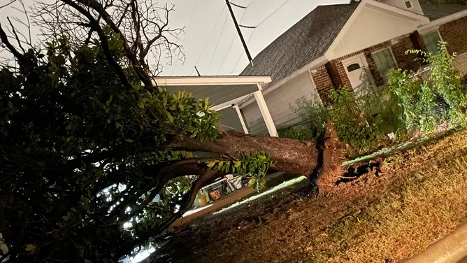
Earlier Friday night, storms battered the Dallas-Fort Worth Metroplex, producing wind gusts up to 67 mph in Fort Worth. Initial radar reports suggested a possible tornado south of Fort Worth, but the NWS survey concluded that straight-line winds up to 85 mph, not a tornado, caused the observed damage. The storms snapped tree branches, downed powerlines, knocked over light poles, and partially damaged roofs.
The thunderstorms also ignited six house fires in Dallas and Denton County. Fire officials confirmed that lightning caused at least some of the blazes. Heavy rain set a daily record at Dallas-Fort Worth International Airport, with 3.10 inches of precipitation, marking the third-wettest October day in 25 years.
Flood Watches remain in effect across eastern Texas, including Houston, with widespread rainfall totals of 2-4 inches and isolated amounts up to 6 inches. The strongest storms could drop 2-3 inches of rain per hour, raising the risk of flash flooding.
The NWS has issued a Level 2 out of 5 severe weather risk for southeastern Texas, southern Louisiana, and parts of southern Mississippi for Saturday. The storms could produce damaging winds, large hail (up to golf ball size or larger), and tornadoes, particularly near Houston and Austin.
The severe weather threat in Texas is expected to subside by Saturday evening, but storms will continue eastward into Louisiana and other Gulf Coast states on Sunday.


Leave a Reply