A strong ridge of high pressure will dominate the weather through most of the workweek, bringing abundant sunshine and above-average temperatures.
Expect breezy conditions over the next few days as slight pressure drops in the Central Plains tighten the pressure gradient.
With falling humidity, especially on Thursday, the fire weather risk will be elevated.
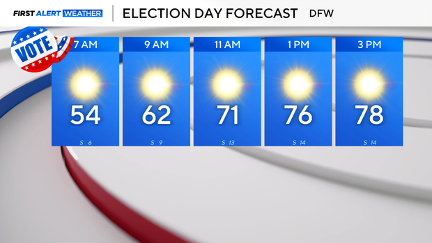
Tomorrow will be another mild and sunny day, beginning in the low to mid-50s across the metroplex and climbing to the upper 70s to near 80 degrees for Election Day.
Temperatures will continue to rise into the lower 80s for the rest of the week ahead of several dry cold fronts arriving over the weekend.
The first front moves in on Friday with minimal effect on temperatures. A stronger front will follow, pushing through Saturday into Sunday.
This stronger front will drop temperatures from near 80 on Saturday to the upper 60s by Sunday and into early next week.


Leave a Reply