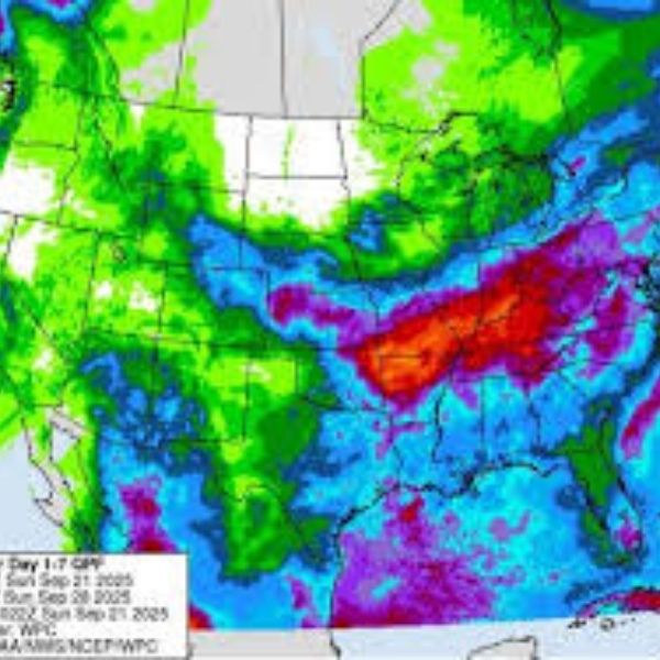
Autumn arrives Monday, September 22, bringing a shift in the weather pattern. After an extended dry spell, the Ohio Valley is set for rainfall this week. The Storm Prediction Center has issued a marginal risk for isolated severe thunderstorms across Central and Eastern Tennessee, much of Kentucky, and nearly all of Ohio except the northwest corner. A weather front is moving in, and a developing storm system later this week will pull in moisture from the Gulf of Mexico and the Atlantic.
The National Weather Service’s Weather Prediction Center forecasts significant rainfall across the Ohio and Tennessee Valleys this week. Some areas could receive more than five inches of rain. Spread over several days, this may limit widespread flash flooding, though localized flash flooding risks will increase as the week progresses. Rainfall will be the main concern in the latter half of the week.
A front will push eastward Monday and Tuesday before stalling across the region. By midweek, low pressure developing over Illinois will draw in moisture from the Gulf, helping to alleviate dry conditions in the Ohio Valley and parts of the Deep South. Late in the week and into the weekend, the frontal boundary is expected to shift toward the Appalachians, ending rainfall from west to east.
Residents are advised to stay updated with the latest National Weather Service alerts throughout the week.
This article has been carefully fact-checked by our editorial team to ensure accuracy and eliminate any misleading information. We are committed to maintaining the highest standards of integrity in our content.


Leave a Reply