More snow is on the way this weekend, and this time it won’t just target the usual areas.
Saturday will begin cold, with temperatures in the upper teens and low 20s. Afternoon highs will climb into the upper 30s as clouds increase. A few isolated light snow showers or sprinkles may develop during the day.
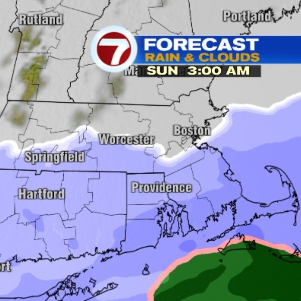
Widespread snow is expected to arrive late Saturday night and continue into Sunday. The steadiest and longest-lasting snow will focus on southern Massachusetts, especially southeastern Massachusetts, the Cape, and the islands.
From Saturday night through Sunday night, those areas are expected to see about 1 to 3 inches of snow. Most of the accumulation will fall overnight into Sunday morning or early afternoon. Some localized ocean-effect snow showers Sunday night could push totals in a few spots closer to 4 inches.
Monday will bring another round of bitter cold and strong winds. Gusts will reach 20 to 30 mph, and with morning lows in the teens and afternoon highs in the upper 20s, it will feel brutally cold despite plenty of sunshine.
Tuesday will stay bright but cold, with lows in the teens and highs in the low 30s. Wednesday turns partly sunny, starting in the teens and warming into the low 40s, though it will be breezy. Thursday begins in the upper 20s, but afternoon temperatures will climb near 50 degrees, feeling unusually mild under partly sunny skies. There will be chances for rain and possibly some wintry weather Thursday evening into Friday. Stay tuned.


Leave a Reply