A new Pacific storm not only threatens to bring more rain back into California, but it may also damp New Year’s Eve revelers and ruin someone’s plans.
Following many days of dry, bright, and windy weather, a new storm with rain and travel delays will hit California later this week.
California and most of the Pacific Coast and interior western United States are finally getting a reprieve from the storms that had been pounding them for weeks in December. The storms dumped one to three months’ worth of rain in only a few days. The dry pattern will remain until Tuesday in most locations, and it is necessary to help streams and rivers drop from their high levels.
The same pattern, however, is producing gusty winds from the Northeast, which locals refer to as a Santa Ana. The severity of this Santa Ana event will be moderate, with gusts of 40-60 mph over the ridges, canyons, and passes. A few locally heavier gusts are possible.
Because of the recent heavy rains in the area, the brush will be damp enough to reduce the risk of flames. There will still be some risk when the brush dries out after a few days.
Wet soil and strong winds may cause some trees’ root systems to fail. This may cause some trees to topple over, which would not ordinarily be an issue during a moderate Santa Ana.
Looking ahead, all dry patterns must end. However, instead of California and the Southwest being dry for weeks, moisture is projected to return by the middle of the week.
This time, moisture will rise from the south and the subtropical Pacific, not from the north or west.
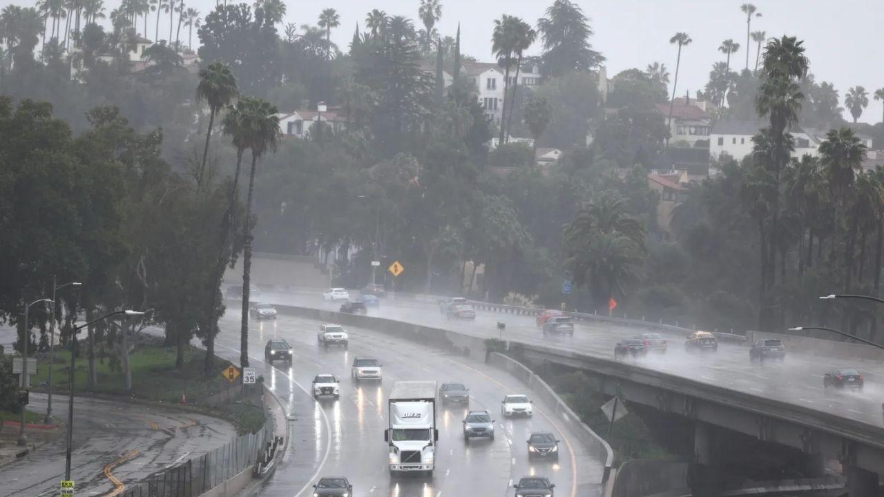
Despite the storm’s subtropical origin, rainfall is forecast to be moderate in general. There will still be areas where the rain is intense enough to increase the risk of mudslides and flash flooding, such as along the Transverse Range’s south and west slopes in Southern California. Fortunately, such significant rain, as well as the associated concerns, will be localized.
Most streams and rivers should be able to withstand the rain without causing serious flooding. Ponding may occur along some roadways and highways with poor drainage.
The showers may interfere with New Year’s Eve celebrations.
Showers will fall across much of Southern and Central California during the afternoon and early evening hours on New Year’s Eve, moving to Northern California, Las Vegas and Reno, Nevada, and Phoenix late Wednesday night and Thursday.
People going to and participating in the annual parade in Pasadena, California, on New Year’s Day may want to wear waterproof shoes, a warm jacket, and a plastic rain poncho, according to AccuWeather. Temperatures are expected to be in the 50s Fahrenheit. Temperatures will rise slightly in the afternoon for the football game, but it is almost certain to rain at least once or twice, and possibly much more frequently.
With the storm, freezing levels will be higher than in Southern California. As the storm moves into the Sierra Nevada from Wednesday night to early Friday, freezing temperatures will rise. There may be some slush near the start at Donner Pass, California.
Showers may not move north into western Oregon and Washington until late Thursday afternoon or evening.
When the main body of the Pacific storm approaches the California coast, which might happen over the first weekend of 2026, freezing levels may dip low enough for snow to fall in earnest over Donner Pass, and significant snow may accumulate in the Sierra Nevada.
The weather for the following weekend will be determined by the storm’s track, with further showers or the possibility of widespread heavy rain returning.


Leave a Reply