A powerful cold front sweeping across the state this evening is likely to cause a swift and considerable decrease in temperatures as Iowans prepare for New Year’s Day. According to forecast data, the coldest air will arrive shortly after dark, with temperatures dropping to the single digits in northern Iowa and the teens in central and southern Iowa by early Thursday morning.
Arctic Air Will Deliver the Coldest Night of the Season
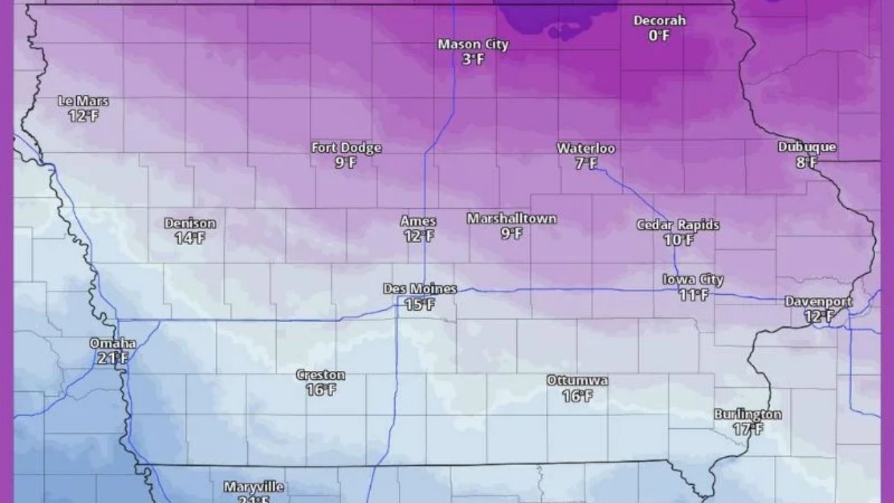
Meteorologists predict that Northern Iowa will bear the brunt of the chilly air mass first. Cities like these:
- Decorah: 0°F
- Mason City: 3°F
- Fort Dodge: 9°F
will suffer dangerously frigid temperatures, with wind chills likely to fall significantly lower.
Farther south, Des Moines (15°F), Ames (12°F), Ottumwa (16°F), and Burlington (17°F) will all experience significant temperature drops compared to recent days.
New Year’s Eve Celebrations May Be Impacted
Those planning to attend New Year’s Eve events should dress warmly, since the coldest air arrives long after dark. Frost and fast-lowering temperatures may cause roads and pathways to become slick in some areas.
Important reminders for homeowners spending time outside tonight:
- Wear insulated winter clothing, gloves, and hats.
- Limit time outside during late-night celebrations.
- Check on elderly neighbors and anyone without reliable heat.
Coldest Readings Expected by Early Thursday
By 6 a.m. Thursday, temperatures will drop statewide:
- Northern Iowa: Single digits and near-zero lows
- Central Iowa: Upper single digits to mid-teens
- Southern Iowa: Mid to upper teens


Leave a Reply