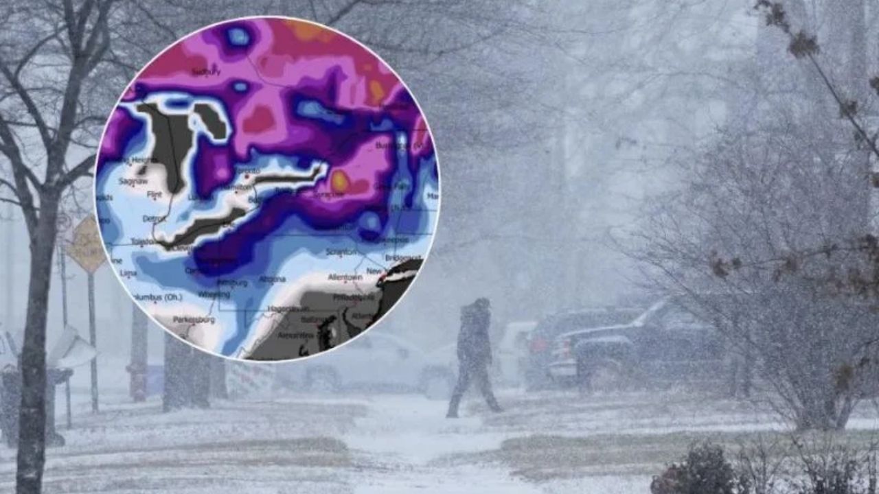
A huge and compelling winter storm will affect many regions of the country during the next 48 to 72 hours, with winter storm warnings in effect across the West, Midwest, Great Lakes, Northeast, and Alaska, according to the most recent forecast data.
Forecasters note that, while snow accumulation will be significant, this storm is more about the mix of heavy snow, strong wind, and long-term consequences.
Blizzard and Near-Blizzard Conditions Likely in Multiple Regions
Forecast data indicates that heavy snowfall will interact with very severe winds, with wind gusts topping 55 mph in several areas and potentially exceeding 100 mph in exposed mountain regions. This combination increases the potential of blizzard or near-blizzard conditions, in which visibility can quickly collapse, making travel extremely unsafe or impossible, even after snowfall begins to taper.
Power Outage and Infrastructure Risks Increasing
Officials warn that snow-laden trees paired with strong winds enhance the likelihood of extensive power outages. Drifting snow may continue to impede highways and mountain routes long after the storm has passed. Forecasters warn that the effects may linger, and cleanup and restoration operations could take far longer than with a usual winter storm.
Travel Could Become Impossible in Impacted Areas
Transportation officials advise citizens to prepare for severely restricted traffic, particularly in high-elevation, open, and wind-exposed places. Even regions that receive moderate snowfall may have perilous circumstances due to blowing and drifting snow. The storm is said to still have tremendous force behind it, which means circumstances might change quickly as it moves eastward.
Safety Guidance Issued for Warned Areas
Residents in vulnerable areas should constantly watch local weather advisories, minimize unnecessary travel, and plan for possible extended power disruptions. Those in mountainous and exposed areas should exercise extra caution, as conditions may change quickly.


Leave a Reply