A moisture plume from near Hawaii is expected to deliver heavy rain, flooding, and avalanche dangers to British Columbia, Washington, and southeastern Alaska, raising worries following recent flooding and severe snowfall.
A lengthy plume of moisture flowing from near Hawaii, a variation of an atmospheric river known as the Pineapple Express, will hit British Columbia and parts of Washington this weekend and into early next week. Heavy rain-induced flooding and an elevated avalanche risk could endanger lives, property, and transport throughout the region.
People in western Washington still remember the tremendous rain and flooding that occurred in December. While the environment has provided some respite from these conditions recently, the weather pattern is preparing to unleash another round of heavy rain, which may result in major floods.
The most rain is forecast on Vancouver Island in British Columbia, where 4 to 8 inches may fall, with higher amounts in isolated areas. Heavy rain is also expected in northwestern Washington and the British Columbia peninsula, particularly on the west-facing slopes of the Olympic and Cascade ranges, as well as the Coast Mountains.
The thick plume began on Friday in central British Columbia and southeastern Alaska, and it is expected to spread southward over the weekend.
Heavy rains in coastal locations may create quick rises in minor streams and rivers, resulting in flooding. Flash flooding is expected in metropolitan areas such as the Interstate 5 corridor near Seattle and Bellingham, Washington, as well as the Vancouver metro area.
Throughout this event, snow levels will remain above Washington’s mountain passes. As rain falls at mid-level elevations and adds weight to existing snow, the avalanche risk rises. Heavy rainfall at lower elevations increases the risk of mudslides and debris flows.
This pattern may provide little or no rain to areas farther south, particularly in Oregon. Some of the most severe conditions may occur further north, where there is deep snow on the ground.
Snow-clogged Juneau, Alaska, at risk for flooding
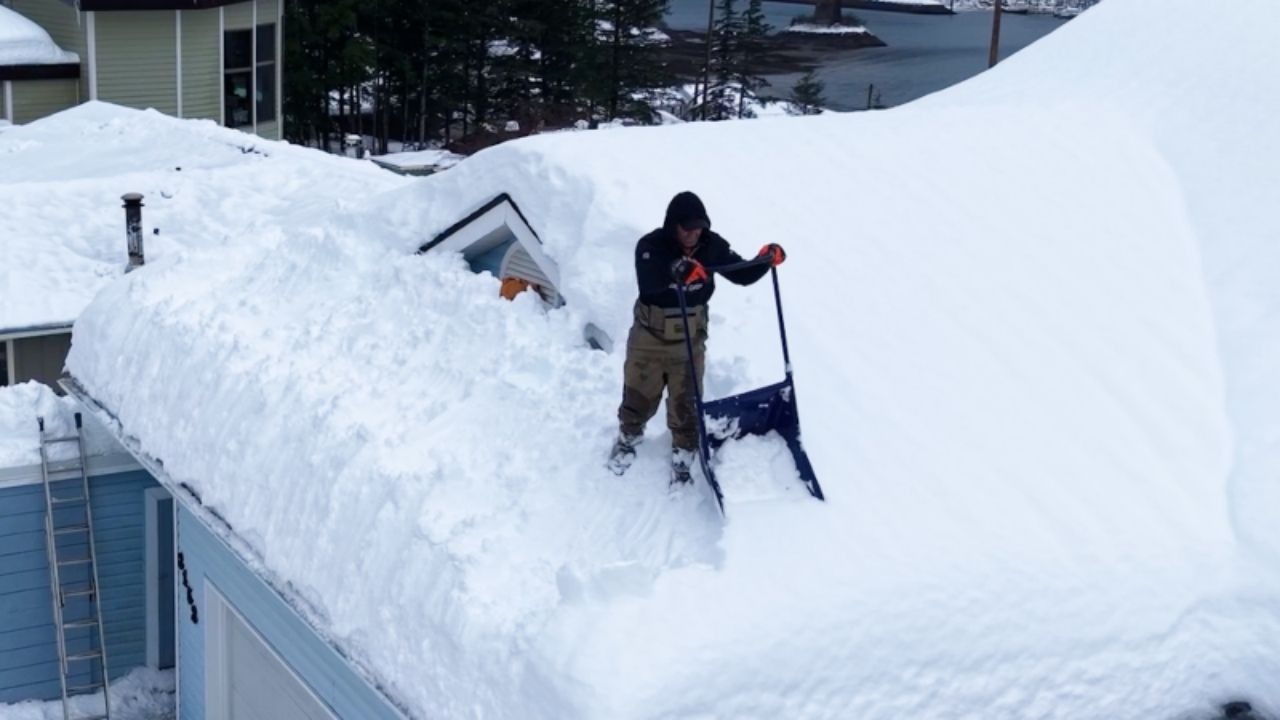
Juneau, Alaska, has been under 92 inches of snow for the past five weeks. That sum is around four times the historical average of 23 inches from December 1 to January 7.
The same weather system that caused heavy rain in British Columbia and northwestern Washington will also strike southeastern Alaska.
“The storm will bring a combination of heavy rain, strong winds and high country snow, with impacts varying significantly across the southeastern Alaska panhandle,” AccuWeather Meteorologist Brandon Buckingham said. “Moderate to heavy rainfall is likely across much of the panhandle on Friday, with 1-3 inches possible through Friday night. Flooding concerns will increase in areas with deep snowpack, even though not all of the snow will melt with this storm. Snow- and ice-clogged storm drains may cause water to pond in locations that typically do not flood.”
Additional storms are forecast next week, delivering more rain to lower elevations. Rain and temperatures above freezing will melt more snow, raising the risk of flooding in Juneau and other portions of southeastern Alaska.






Leave a Reply