Florida’s waters are on the move as a low-pressure system over the Gulf of Mexico and its stationary front across the state stir the Gulf waters, creating hazardous conditions for boaters and swimmers along the Gulf Coast. Small craft advisories remain in effect at the start of the week, even as the low-pressure system moves west. Another low-pressure system may develop near the Bahamas, and a cold front from the north later this week is expected to increase winds and maintain advisories, particularly along the Gulf Coast.
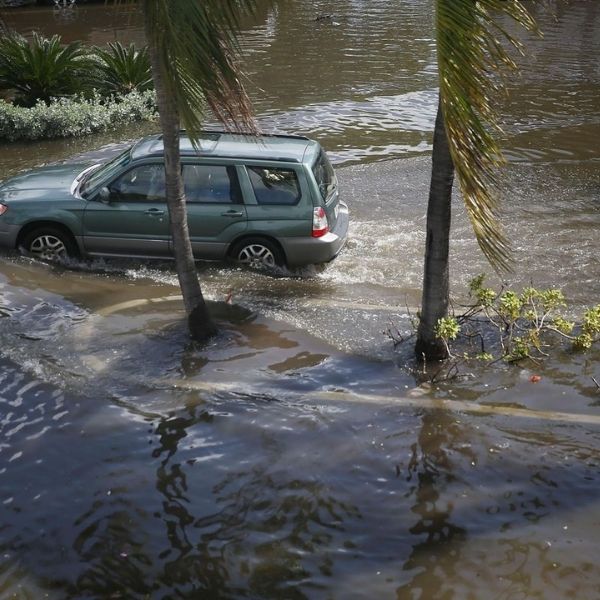
King Tides and Coastal Flooding
The state is experiencing King Tides, also called perigean spring tides, which occur when the Sun and Moon’s gravitational forces align to pull on Earth’s oceans. These are the highest tides of the year, typically appearing several times between September and November. Peak tides are expected October 5–12.
King tides worsen the impact of rising sea levels, mixing saltwater with sewage, flooding streets, damaging vehicles, and posing health risks. Residents are advised to avoid walking through floodwaters, especially if they have open wounds, as infections could result.
High tides this week are expected to be about 1 foot higher than usual. For example, in Jacksonville Beach, normal high tides of 5 feet may rise to 6.3–6.6 feet between 8 a.m. and noon from October 7–13. Similar conditions are expected along Florida’s entire East Coast.
East Coast
The Atlantic Coast will be most affected. Strong east winds will churn seas, increase rip current risks, and exacerbate coastal flooding, even without rain. Small craft advisories are in effect for most of the week. While seas may decrease slightly Thursday and Friday, winds will remain strong, potentially causing coastal flooding at high tide, especially if scattered afternoon storms occur simultaneously.
North Gulf Coast
Small craft advisories remain along offshore waters near the Panhandle at least until 1 p.m. Monday. Although seas may slightly ease Tuesday and Wednesday, winds up to 20 knots will persist, increasing to 25–30 knots Thursday onwards, with seas reaching up to 6 feet at times. Coastal flood warnings are expected to stay in effect much of the week.
West Coast
Strong east winds will continue through the week. Small craft advisories remain in effect at least until Tuesday for near-shore and offshore waters between Punta Gorda and Cider Key. Mariners, especially those with small vessels, are urged to avoid hazardous conditions. Afternoon heating combined with strong east winds may generate afternoon storms pushed toward the coast through Wednesday. Afternoon highs are expected to remain in the upper 80s to lower 90s.
Residents and mariners should remain cautious this week, as high tides, strong winds, and potential storms combine to increase coastal flooding risks across Florida.
This article has been carefully fact-checked by our editorial team to ensure accuracy and eliminate any misleading information. We are committed to maintaining the highest standards of integrity in our content.


Leave a Reply