After a brief period of milder conditions in portions of the South, forecast data now shows that winter may return between January 20 and January 22, with snow possible in numerous states that have recently experienced wintry weather.
The most recent model guidance shows a renewed ring of cold air and snow potential aligning across North Mississippi, North Alabama, Tennessee, Arkansas, and parts of northern Louisiana, indicating that winter weather may return swiftly after folks began to relax cold-weather preparations.
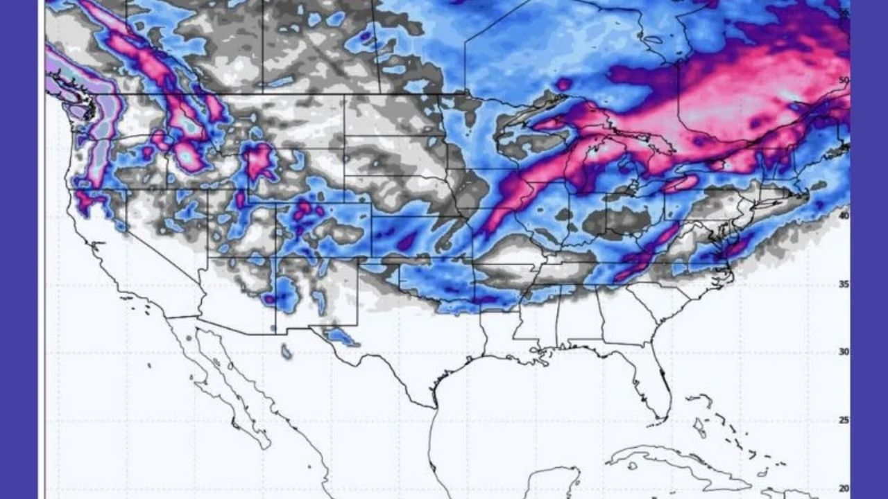
Forecast Signals Point to Snow Returning to Familiar Areas
Both major forecast models used in the data suggest a similar configuration to previous winter events, with snow bands extending throughout the same broad corridor hit earlier this season. The strongest signal is observed across:
- North Mississippi
- North Alabama
- Tennessee
- Arkansas
- Northern Louisiana
While specific snowfall levels remain uncertain in this range, model runs show consistent placement and timing, raising confidence that at least some snow or wintry precipitation is expected in these places.
Timing: January 20 Through January 22
Based on the maps, the most likely window for impacts appears to be late January 20 to January 22. This scheduling places probable snowfall after inhabitants have habituated to warmer weather, which might exacerbate surprise and preparedness concerns.
Forecasters warn that confidence levels may decline or fluctuate slightly as the event approaches, but the persistent recurrence of this scenario across models indicates that the threat cannot be ignored.
Why This Setup Matters
The data reveal a trend in which cold air might rush south again, catching warmer air off guard. This type of configuration can result in:
- Rapid temperature drops
- Rain transitioning to snow
- Travel disruptions, especially overnight
- Surprise accumulations in areas not typically snow-prone
The issue is not excessive cold, but time and expectations, as many residents may believe winter has passed.
Forecast Still Subject to Change
It is vital to remember that this forecast is still vulnerable to change, particularly regarding:
- Exact snowfall totals
- Northern or southern shift of the snow band
- Rain versus snow lines
However, the repeating signal across various models suggests that monitoring should continue, particularly in communities impacted earlier this winter.


Leave a Reply