A cold front is predicted to move in from the north and west on Sunday, causing temperatures to drop sharply across the region overnight Sunday into Monday.
Travelers should exercise caution in the morning, as patchy, dense fog spread across the region early Sunday. Visibility has decreased below a quarter of a mile in some areas, so proceed with caution at slower speeds before the sun burns it off.
On Sunday, afternoon highs in the region are anticipated to reach the 70s, with winds gradually increasing. As the cold front passes, there is a low possibility of a stray shower or two.
Clouds are expected to develop throughout the afternoon before the chilly air comes, so grab your jacket if you want to be out late.
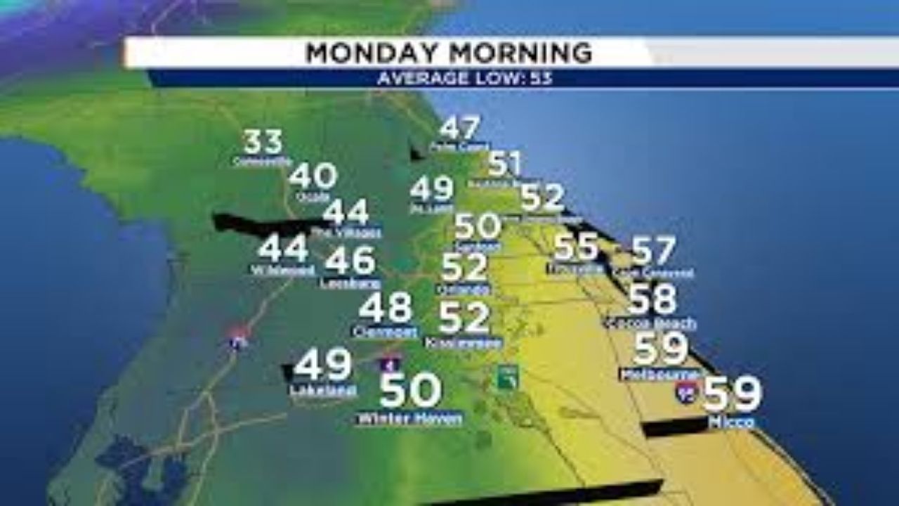
Monday morning is expected to be very cold, with lows in the 40s but feeling like the 30s in some areas.
That’s a significant departure from the average highs of 73 to 74 degrees in December.
Wind and high-surf advisories in effect
This gusty change is more than just about cooler air. Windy conditions are forecast to begin Sunday night and last until Monday morning. Winds from the north could reach 20 to 25 mph, with gusts over 40 mph in isolated places.
Anyone near the ocean should keep an eye out for a high surf advisory, as waves are expected to reach 7 to 10 feet, increasing the risk of beach erosion and making the waves dangerous for swimmers and surfers.
If you don’t like chilly weather, there’s good news: this chill won’t last long. A warming trend is expected to return by midweek, pushing highs back into the 70s and even around 80 degrees by next weekend.
Monday and Tuesday will be below average, but by Friday and Saturday, it should feel more like a typical Central Florida winter—mild and pleasant.


Leave a Reply