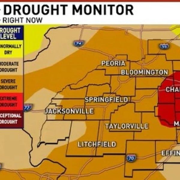
SPRINGFIELD, Ill. (WICS) — After weeks of dry conditions, central Illinois is set to see significant rainfall this weekend. Springfield hasn’t recorded more than a quarter inch of rain since September 20, and the last substantial soaking over an inch occurred July 25.
Weekend Weather Overview
A strong low-pressure system moving into the Great Lakes will drag a cold front across central Illinois.
-
Friday: Increasing clouds and unseasonably warm temperatures, with highs near 80°F.
-
Saturday: Showers and scattered storms develop, some potentially strong. The Storm Prediction Center has placed the region under a Marginal Risk for severe storms. Most areas can expect 0.75–1.5 inches of rain, with isolated spots receiving 2 inches or more. This will be the heaviest rain central Illinois has seen in months, though it won’t completely erase the rainfall deficit.
Sunday: Lingering wrap-around showers and isolated storms are possible behind the cold front. By late afternoon, skies will begin to clear, bringing cooler temperatures. Brisk northwesterly winds of 30–40 MPH will usher in seasonable October highs in the low to mid 60s.
Residents are advised to prepare for heavy rain and gusty winds, especially during Saturday’s peak storm period.


Leave a Reply