Cold front to bring brief rain before sunshine returns for the weekend
Patchy fog to areas of dense fog will develop tonight and early Tuesday across inland northeast Florida and southeast Georgia.
Skies will stay partly cloudy before turning mostly cloudy on Wednesday as the next cold front approaches Thursday afternoon and moves through early Friday morning. Afternoon highs will hold steady in the upper 60s to 70s through Friday.
The weekend is shaping up nicely, with plenty of sunshine, mild morning lows, and comfortable afternoon temperatures. It’s perfect Open Window Weather.
Tonight: Partly cloudy and not as cold. Temperatures fall into the upper 30s to 40s inland, with 40s to 50s along the beaches.
Wednesday: Clouds increase as a cold front approaches from the west. Morning temperatures start in the upper 30s to 40s across southeast Georgia and in the 40s to 50s across northeast Florida. Afternoon highs rise into the 60s to low 70s. Skies turn cloudy overnight with rain chances increasing by Thursday.
Thursday–Friday: Mostly cloudy with a chance of showers from Thursday into early Friday. Current forecast models suggest rainfall totals ranging from about 0.10 to near 1.0 inch. Isolated storms are possible over southeast Georgia and southern parts of northeast Florida.
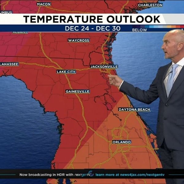
Long-range temperature outlooks suggest warmer-than-normal conditions will continue through Christmas, so keep those flip-flops close.
Sunrise: 7:17 a.m.
Sunset: 5:28 p.m.
This article has been carefully fact-checked by our editorial team to ensure accuracy and eliminate any misleading information. We are committed to maintaining the highest standards of integrity in our content.


Leave a Reply