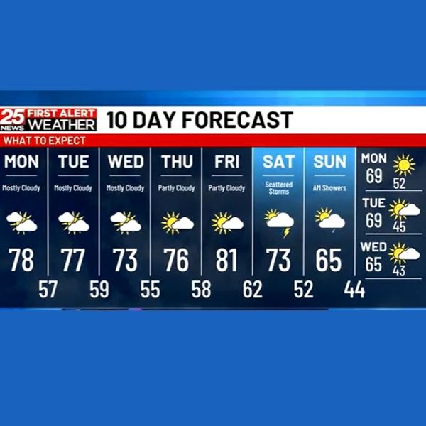
PEORIA (25News Now) — A storm system over southern Canada is driving a cold front across the Plains tonight, expected to reach Illinois by morning. Some light showers may develop west of the Illinois River late tonight into early Monday, but most areas will remain dry. Overnight lows will fall into the 50s, with Monday’s highs reaching the mid to upper 70s.
The rest of the week will be mostly quiet and warm. Temperatures will dip slightly into the low to mid-70s by Wednesday before rebounding to the upper 70s and low 80s by Friday. Rain chances return this weekend as another system moves in, bringing the potential for scattered showers and a few storms from Friday night into Saturday.
This article has been carefully fact-checked by our editorial team to ensure accuracy and eliminate any misleading information. We are committed to maintaining the highest standards of integrity in our content.


Leave a Reply