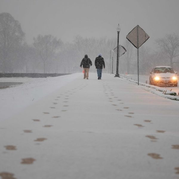
CHICAGO, ILLINOIS — A powerful winter storm moving east from the Plains is set to impact millions across Illinois, Ohio, Michigan, and the Northeast through Tuesday, bringing a wide swath of heavy snow, freezing rain, and hazardous travel conditions from Chicago to New York City.
Meteorologists say the system will strengthen overnight, delivering 2–9 inches of snow across multiple regions and creating slick roads throughout the Great Lakes, Ohio Valley, and Northeast.
Snowfall Forecast for Key Cities
As the storm shifts east, precipitation will change from cold rain to snow and sleet, with accumulations increasing into Tuesday morning.
• Chicago, Illinois: 2–4 inches of snow expected by early Tuesday, with gusty winds and slippery roads for the morning commute.
• Detroit, Michigan: 3–5 inches of snow possible, with steady snowfall reducing visibility throughout the day.
• Columbus, Ohio: 3–5 inches of snow forecast, with icy patches forming on untreated surfaces.
• Nashville, Tennessee: A glaze of ice likely overnight before colder air turns precipitation into snow.
• New York, Boston, and Northern New England: 6–9 inches of snow expected by Tuesday night, marking one of the first significant Northeast snow events of the season.
Forecasters also warn that ice in the Mid-South and central Appalachians could worsen driving conditions, especially along I-40 and I-70.
“This is a wide-reaching winter storm bringing snow and ice from the Midwest to the Northeast,” forecasters said Monday evening. “The greatest snow totals are expected from central Ohio to New England, where travel could become extremely difficult.”
Travel Disruptions Likely
Both road and air travel are expected to be heavily impacted. Airports in Chicago, Detroit, Columbus, New York, and Boston are preparing for delays and cancellations as snow bands intensify.
Major interstates — including I-55, I-70, I-80, I-90, and I-95 — could see snow-covered pavement, reduced visibility, and icy stretches through Tuesday.
Officials are urging drivers to avoid unnecessary trips and keep emergency supplies on hand, such as blankets, flashlights, and water.
Storm Timeline
• Monday Night: Light snow spreads from Missouri and Illinois into Indiana and western Ohio.
• Tuesday Morning: Heavier snow develops across Chicago, Detroit, and Columbus; ice possible farther south.
• Tuesday Afternoon and Evening: Snow reaches New York, Boston, and New England, increasing overnight.
• Wednesday Morning: The storm moves off the coast, leaving bitter cold and gusty winds.
Bitter Cold to Follow
After the system passes, temperatures across the Midwest and Northeast will plunge. Highs will remain in the 20s across Illinois, Indiana, and Michigan, with wind chills dropping into the single digits by Wednesday morning.
Forecasters warn of refreezing overnight, which could create additional hazards for early commuters.
What Residents Should Do
• Check flight delays or cancellations before going to the airport.
• Avoid driving during heavy snow or icy conditions.
• Prepare for possible power outages in areas expecting ice.
This storm is shaping up to be one of the most widespread winter events so far this season, stretching from the Midwest to the Northeast with a mix of snow, ice, and arctic air.
This article has been carefully fact-checked by our editorial team to ensure accuracy and eliminate any misleading information. We are committed to maintaining the highest standards of integrity in our content.


Leave a Reply