
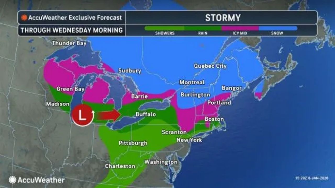
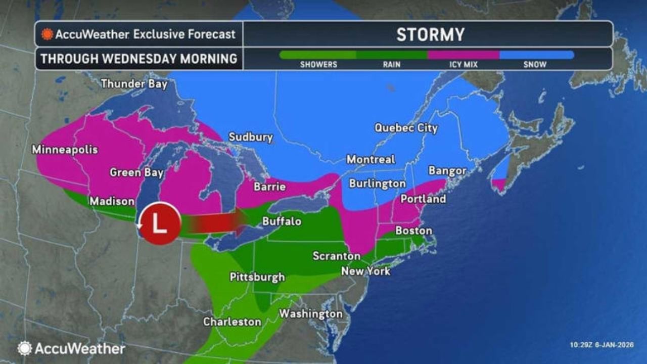
Fairly mild winter weather is forecast to persist across much of the Mid-Atlantic from January 10 to 14, keeping the probability of significant snow accumulation low in Pennsylvania and Maryland but allowing for periodic rain or brief wintry mixtures.
According to the National Weather Service Climate Prediction Center, the region is expected to experience above-average temperatures for the next 6–10 days, with precipitation levels remaining near normal. This combination indicates that rain will be the predominant form of precipitation, with only a few chances for snow, primarily during the nighttime or early morning hours when surface temperatures temporarily drop.
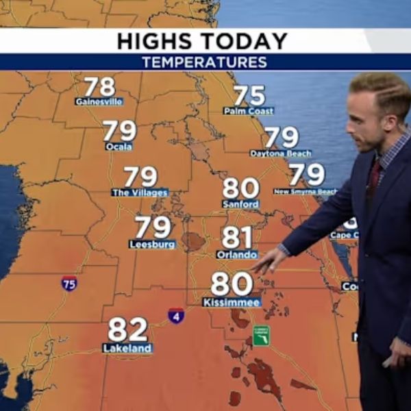
Short-lived rain-to-snow transitions are possible in central and northern Pennsylvania, including regions near State College, Williamsport, and the Laurel Highlands, if colder air arrives on time. Any accumulation would probably be modest and limited to higher elevations. Further south in Maryland, including Baltimore, Frederick, and the I-95 corridor, precipitation is forecast to fall primarily as rain, with little winter impact.
Travel problems look unlikely, but isolated slippery spots on untreated roads during the early morning hours cannot be ruled out, particularly in hilly terrain. Drivers should exercise caution during any midnight precipitation events.
Overall, the setting favors low-impact systems over extensive winter storms. While temporary advisories may be issued if colder air persists for longer than projected, significant snow alerts are not forecast as the January 10-14 timeframe approaches.


Leave a Reply