A developing mid-January winter pattern is attracting interest across the South, as long-range European weather model data suggests that renewed cold air and accumulating snow may return between January 12 and January 15, despite recent springlike conditions in the region.
Forecasts suggest that winter may not be over yet, particularly in regions of the Lower Mississippi Valley, Tennessee Valley, and southern Plains, where colder air may surge southward and combine with remaining moisture.
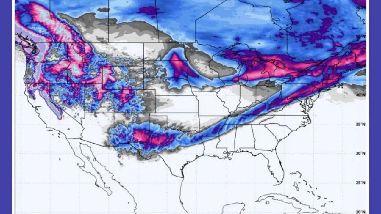
Long-Range Model Signals Point to Winter’s Return
The most recent European (ECMWF) model run indicates a wide swath of snow possibility extending from Texas through the Mid-South and into the Ohio Valley, indicating a pattern shift that contrasts starkly with recent warm weather. While this data is still long-term and not yet locked in, the consistency of colder signals returning in mid-January raises concerns about travel interruptions, icy conditions, and unexpected temperature reductions throughout numerous southern states.
States That Could See Impacts If the Pattern Holds
According to current model estimates, the areas with the strongest signals for snow or wintry precipitation are Texas, Louisiana, Arkansas, Mississippi, Tennessee, northwestern Alabama, and Kentucky.
The model shows probable snow bands cutting across these locations, indicating that winter weather may affect areas not used to mid-January snowfall, particularly if surface temperatures drop swiftly after nightfall.
Why This Setup Matters Despite the Long Range
Forecasters note that, while this is not an official forecast, it serves as a warning shot that winter patterns may return following a brief mild spell. Historically, such settings have resulted in quick changes, with confidence increasing only days before impact, leaving citizens and transportation officials in the South with little time to prepare.
Temperature Whiplash and Public Complacency Concerns
Recent warmth has prompted many to hope that winter is over, but meteorologists warn against complacency. Cold air masses can still move south in January, particularly when jet stream patterns realign.
If this pattern continues, people may suffer dramatic temperature dips, freezing overnight lows, and snow accumulation, even in locations that had felt springlike.


Leave a Reply