Central Floridians awoke to a substantially chilly Monday morning as a cold front blew through the region, bringing some of the coldest temperatures in recent weeks. Orlando’s temperature has dropped dramatically, reaching only the mid-60s this afternoon, roughly ten degrees below the seasonal average.
Windy and cold conditions kick off the week
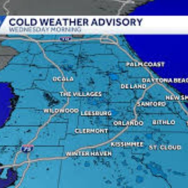
Monday morning, temperatures in Central Florida dropped into the 40s and 50s, followed by gusting winds that made it feel considerably colder. Coastal areas experienced extremely breezy conditions, with a wind advisory in force until 9 a.m. for gusts of 35 mph or higher.
The combination of chilly air and strong gusts generated a perceptible chill factor for those leaving early. According to FOX Storm Team meteorologist Brooks Garner, Orlando’s high temperature will only reach about 65 degrees today, significantly below the average mid-70s for mid-December in Central Florida.
Residents may expect a combination of sunlight and clouds throughout the day, as well as partially clear sky. Despite the sun’s appearances, the colder air mass will keep temperatures lower than what Central Floridians have experienced in previous days.
Another chilly night ahead before gradual warmup
The chilly temperatures will not go away immediately. Monday night will bring another round of frigid temperatures, with lows in the 40s and 50s on Tuesday morning. Those planning early morning activities or commutes should be prepared for the continued chilly temperatures.
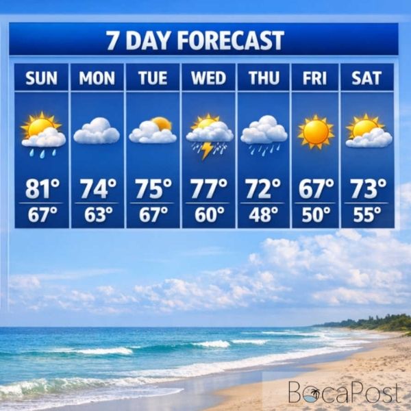
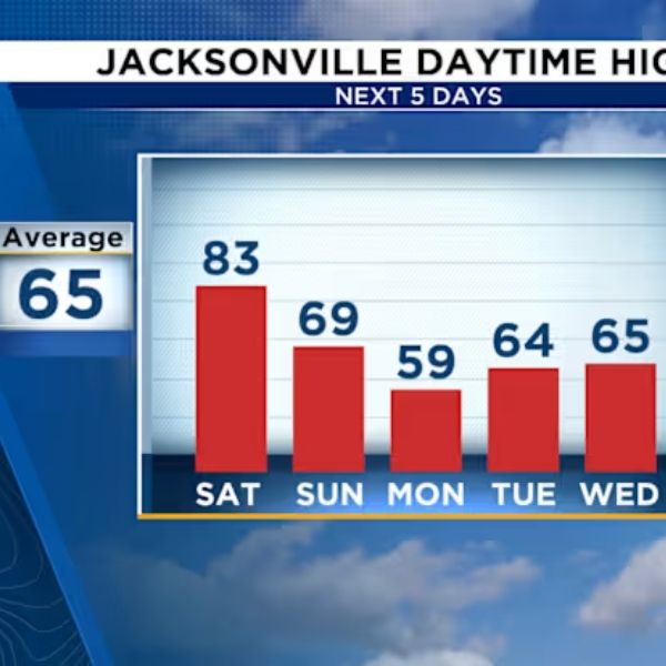
However, relief is on the horizon for those who miss Florida’s typical mild winter weather. Temperatures will gradually rise back to normal levels beginning Tuesday, with highs in the mid-60s and lower 70s. The warming trend will continue this week as the cold front moves away from the region.
By Wednesday and Thursday, Central Florida will feel substantially more comfortable as temperatures rise. The pattern shift marks a speedy reversal from Monday’s below-normal weather.
Weekend warmup brings return to 80-degree highs
The big benefit for those who prefer warmer weather begins this weekend. Forecasters estimate temperatures will rise to the mid-70s and lower 80s by Saturday and Sunday, reversing Monday’s chill.
This weekend’s warmth will return Central Florida to the comfortable temperatures that attract visitors to the Sunshine State throughout the winter months. The temperature change of 15 to 20 degrees from Monday to the weekend exemplifies the unpredictability that characterizes Florida’s winter weather patterns.
A weak weather disturbance may deliver a few patchy showers Thursday and Friday as the warming trend continues. However, rain prospects remain low, with forecasts predicting only a 20% chance of precipitation over that timeframe. Any showers that do form are likely to be brief and scattered rather than widespread.
What Central Florida residents should know
While the current cold snap is apparent, it is consistent with Central Florida’s winter weather fluctuation. Temperature variations of 10 to 15 degrees are normal as cold fronts travel across the region during the cooler months.
Those with outdoor plans this week will need an extra layer on Monday and Tuesday mornings, especially if they are going to be outside early. Temperatures will moderate by midweek, making lighter clothing appropriate again.
The gusty conditions associated with Monday’s cold front will progressively subside as the day goes on, with calmer winds forecast by Monday evening. Coastal areas had the greatest winds in the morning, but conditions are expected to improve dramatically by afternoon.
Looking beyond the immediate forecast
Following this weekend’s warmth, Central Florida’s weather pattern should stay fairly consistent, with temperatures holding around or slightly above normal for late December. The swift temperature rebound following Monday’s cold front underscores why Florida is still a winter destination, even during brief frigid spells.
The lack of considerable rain in the forecast implies that outdoor holiday activities and weekend plans should go ahead as planned. The dry trend is typical for Central Florida in December, when the region frequently suffers the driest conditions of the year.
For those keeping track of the bigger picture, this cold front is one of several that usually pass through Florida over the winter months. Each delivers short cooling followed by a return to moderate conditions, resulting in the unpredictable but generally pleasant winter weather that Central Florida is known for.
Residents should enjoy the weekend warmth while it lasts, as winter weather patterns can change swiftly. For the time being, the forecast provides an excellent preview of why December in Orlando remains popular with both locals and visitors looking for pleasant outdoor weather.






Leave a Reply