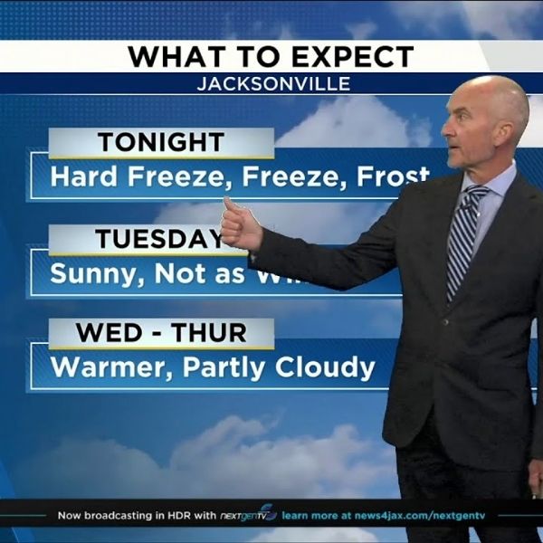
A Freeze Warning went into effect at 7 p.m. and will remain in place until 9 a.m. Tuesday as a blast of cold air moves across the region.
Inland areas are expected to see temperatures drop sharply overnight, with a Hard Freeze forecast for inland southeast Georgia and a Freeze Warning issued for northeast Florida.
Conditions will turn sunny, cool, and less breezy on Tuesday, with temperatures gradually warming through the rest of the week. Clear and cool conditions overnight may lead to patchy frost in parts of southeast Georgia.
Tonight: Freeze Warning from 7 p.m. to 9 a.m., clearing skies, and light winds.
Tuesday: A cold start with below-normal afternoon highs under sunny skies. The day will begin under a Freeze Warning before warming later on. Morning lows will fall into the 20s and 30s across southeast Georgia, and the 30s, 40s, and 50s in northeast Florida. Afternoon highs will reach the upper 50s to near 60 degrees. Winds will be from the north-northeast at 5 to 10 mph, with clear and cool conditions overnight.
A warming trend is expected to begin Wednesday, with a slight chance of showers possible late Thursday into early Friday.


Leave a Reply