The Atlantic remains still under steady trade winds, offering a welcome pause after an unpredictable hurricane season.
For the first time in months, forecasters aren’t tracking any developing systems across the North Atlantic, Caribbean, or Gulf of Mexico. The National Hurricane Center confirms no tropical cyclone formation is expected over the next seven days. After months of turbulent weather, this calm feels like a much-needed break.
Cooler ocean waters and stronger upper-level winds are suppressing storm development — classic signs that the season is winding down. While November can still bring surprises, coastal communities from Florida to the Carolinas can breathe a little easier this week.
NOAA’s Season Outlook vs. Reality
Back in May, NOAA predicted an above-normal hurricane season with:
-
13 to 19 named storms
-
6 to 10 hurricanes
-
3 to 5 major hurricanes
So far, the season has delivered its fair share — from Tropical Storm Andrea to the powerful Category 5 Hurricane Erin — impacting areas from the Caribbean to the U.S. East Coast. Although the pace has slowed, the overall activity still aligns with the early forecasts.
NOAA’s confidence in these predictions was around 70%, using advanced modeling of sea surface temperatures, wind patterns, and atmospheric shifts. Adjustments in August slightly lowered the outlook, but the above-normal expectation remained. With the official end on November 30, attention now turns to any late-season developments.
A Look Back at 2025’s Tropical Activity
This season started later than usual, as the first named storm — Andrea — didn’t form until June 23, marking the latest start since 2014.
Storm highlights include:
-
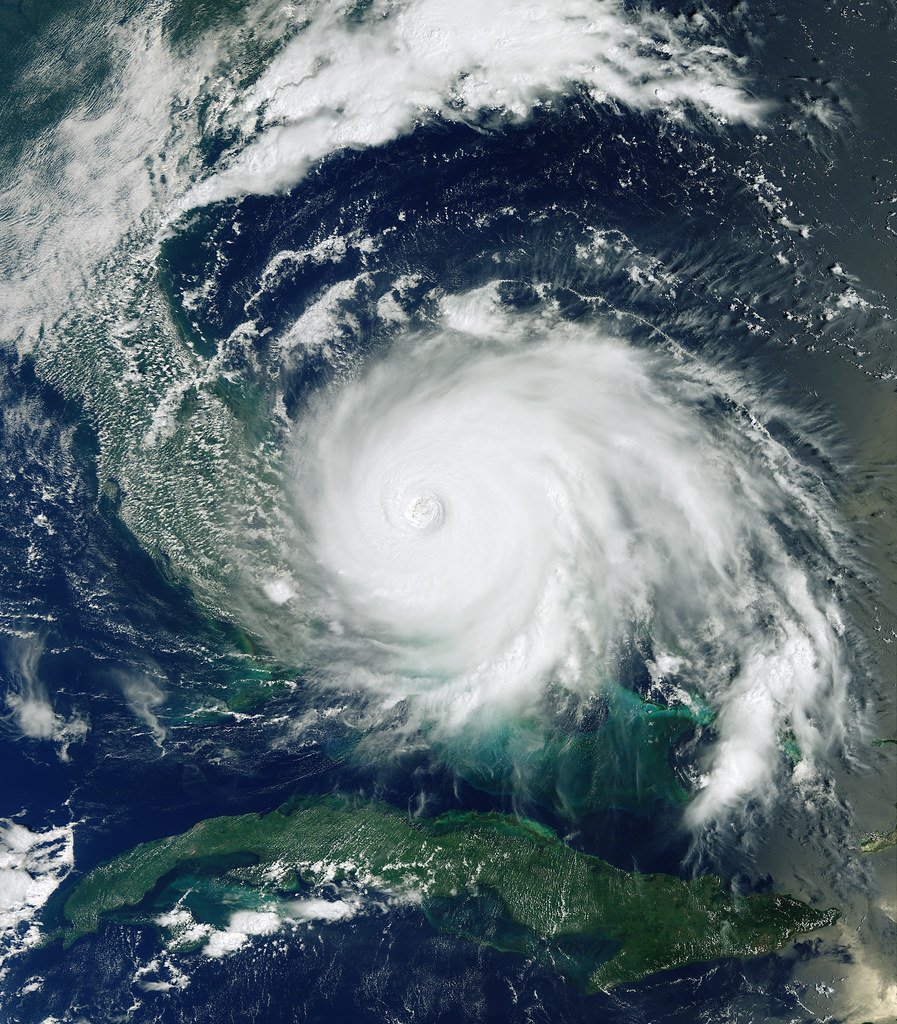
Hurricane Erin: Reached Category 5 and passed near Cape Verde.
-
Tropical Storm Chantal: Brought heavy rain to the East Coast.
-
Barry: Made landfall in Mexico early in the season.
Many storms curved out to sea, limiting major impacts. Despite a brief lull in August, the season’s totals remain close to NOAA’s original expectations — a reminder of how quickly tropical dynamics can shift.
Could November Still Bring Surprises?
History shows November can still produce storms — three hurricanes have struck Florida this month, though major Gulf systems are rare.
Current models suggest a winter-like pattern setting in, with colder upper air limiting storm growth. However, forecasters are watching the southwestern Caribbean, where warm waters linger and could support development mid-month.
The NHC emphasizes staying alert through November 30. While the chances of major storms remain low, a quick tropical depression isn’t out of the question.
Preparedness During the Calm
Even in quiet times, hurricane readiness remains important. Coastal residents should:
-
Stock up on water, non-perishables, and flashlights
-
Review evacuation routes
-
Trim trees and secure outdoor items
-
Sign up for weather alerts and community notifications
Quiet periods are ideal for preparation — ensuring you’re ready if conditions change suddenly.
Lessons from Past November Storms
Late-season storms have made history before:
-
Hurricane Kate (1985): Formed late November and entered the Gulf.
-
1935 Labor Day Hurricane (late impacts): A reminder that storms don’t follow calendars.
Historical patterns show November systems often form in the Caribbean and track northward. While 2025 could still see a brief storm, experts believe any development would likely be modest.
Season Summary Table
| Aspect | Predicted (May 2025) | Actual So Far |
|---|---|---|
| Named Storms | 13–19 | At least 4 major systems |
| Hurricanes | 6–10 | Several, including Cat 5 |
| Major Hurricanes | 3–5 | 1+ (Erin) |


Leave a Reply