An active weather pattern will persist across South Florida through the rest of the work week.
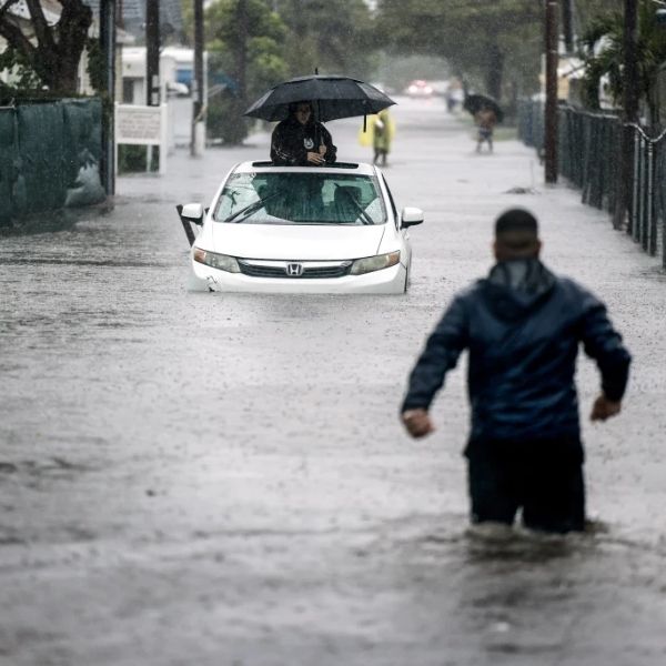
Rounds of rain will continue Thursday with a risk of flooding. The Weather Prediction Center has placed Broward and Miami-Dade counties under a level 1 flash flood risk.
An upper-level low and a stalled surface boundary will keep the atmosphere moist and unstable. Scattered showers moved in during the morning, and more widespread storms are expected this afternoon with heavy downpours at times.
After several days of rainfall, another 1 to 2 inches is possible today. High temperatures will trend lower thanks to abundant cloud cover and the cooling effect of showers and storms, with afternoon highs in the mid to upper 80s.
On Friday, the low-pressure system will begin shifting north, allowing deep tropical moisture to decrease slightly. Despite this, conditions remain unsettled with scattered storms possible. Because the ground is already saturated, flooding could still occur. The Weather Prediction Center continues to list a level 1 out of 4 flash flood risk. With less cloud cover, highs will warm closer to 90 degrees.
This weekend, drier air will lower rain chances somewhat. Passing storms are possible Saturday and Sunday, but rainfall won’t be as widespread as recent days. Highs will climb into the upper 80s with more sunshine.
Early to midweek next week, high pressure will develop and further reduce rain chances. Monday marks the first official day of fall, but South Florida will feel more like summer with highs in the low 90s and spotty storms in the forecast through midweek.


Leave a Reply