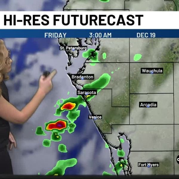
As the evening and overnight hours approach, a 40% chance of rain is expected as showers move toward the viewing area.
SARASOTA, Fla. (WWSB) — Today: A cold front remains positioned to the northwest, while a trough of low pressure has increased cloud cover and sparked scattered storms across Florida, mainly to the north.
Tonight: Rain chances increase to 40% as showers approach the area during the evening and overnight hours. Low temperatures will stay very mild, ranging from the upper 60s to near 70 degrees.
Tomorrow: The cold front is expected to pass on Friday, but warm conditions will continue with highs near 80 degrees. Winds will increase to around 10–15 mph, with gusts reaching 15–20 mph.
Short term: By the weekend, the cold front will begin to influence temperatures, though only slightly. Highs will dip a few degrees into the mid to upper 70s, keeping conditions comfortable across the Suncoast.
Long term: Behind the front, high pressure will build in, bringing more sunshine and gradually warming temperatures. By the middle of next week, highs will climb back near 80 degrees and are expected to hold through Christmas.
This article has been carefully fact-checked by our editorial team to ensure accuracy and eliminate any misleading information. We are committed to maintaining the highest standards of integrity in our content.


Leave a Reply