Snow showers may occur around Saturday morning, with a leading disturbance, although at worst, only a coating is forecast. Snow begins to fall steadily in the afternoon, with the biggest accumulation expected Saturday evening. Expect snow-covered roads and difficult travel conditions.
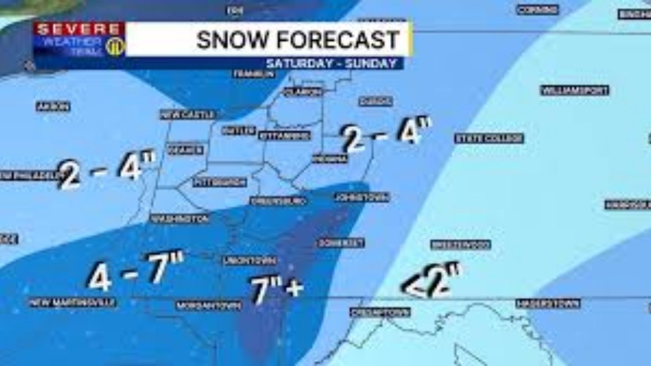
Snow showers caused by lake effect are likely Sunday, particularly north of Butler, where larger amounts are possible. The combined totals will be between 2 and 4 inches in Pittsburgh, but more than 4 inches south of Washington and Greensburg. Totals will easily exceed half a foot along the ridges, including at ski resorts.
A winter storm warning will be in place for counties south of Pittsburgh, including Westmoreland, Washington, and Fayette, from 1 p.m. Saturday until 1 p.m. Sunday.
The rest of our viewing area, including Allegheny, Armstrong, Beaver, Butler, Lawrence, and Indiana counties, was also under a Winter Weather Advisory at the time.
The cold and wind will be the bigger story on Sunday, with sub-zero wind chills anticipated in the morning and no improvement throughout the day.
Cold weather will continue throughout Monday and early Tuesday before a mild warmup by the middle of next week! There is hope for improvement!


Leave a Reply