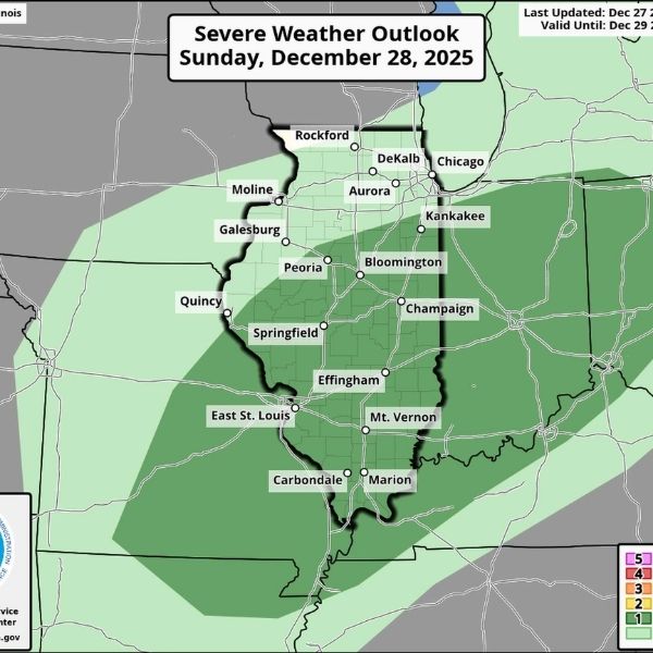
A marginal risk for severe thunderstorms is in place for Illinois on Sunday as a powerful cold front is expected to sweep across the state.
According to the Storm Prediction Center, the approaching cold front could bring the potential for severe weather, followed by a dramatic temperature drop of nearly 40 degrees across Illinois.
The cold front is forecast to move through western Illinois on Sunday, bringing precipitation and the possibility of thunderstorms during the afternoon hours. The Storm Prediction Center issued the marginal risk as the system deepens and pushes colder air into the region.
“A strong cold front will bring precipitation to the region on Sunday afternoon. There is a 50% chance that there will be enough instability to support thunderstorms,” the National Weather Service in St. Louis said. “If thunderstorms do develop, a few will likely (70% chance) be capable of producing damaging wind gusts or a brief tornado.”
The front is expected to move from northeast Missouri around midday and sweep through southern Illinois by Sunday evening. The St. Louis NWS noted that forecast models are split, with about half indicating thunderstorm development and the other half showing limited storm activity. Any tornadoes that form are expected to be weak.
Ahead of the front, temperatures are forecast to climb into the high 60s to low 70s across much of Illinois Sunday afternoon. Areas such as the St. Louis region could reach near 70 degrees, while Jacksonville may see highs around 67.
That warmth will be short-lived. Once the cold front passes, strong winds and sharply colder air will follow. The St. Louis NWS said gradient winds are expected to increase as an Arctic air mass moves in Sunday evening and overnight.
“We would not be surprised to see some gusts approach 45 mph Sunday night into Monday,” the weather service said. “Otherwise, temperatures will quickly plummet behind the front.”
By Monday, Dec. 29, high temperatures are expected to struggle to reach the upper 20s. Forecast highs are around 29 degrees in the St. Louis area and near 24 degrees in Jacksonville, marking a temperature drop of more than 40 degrees in about 24 hours.
Despite the rapid cooldown, forecasters said a flash freeze is not expected with this system.
This article has been carefully fact-checked by our editorial team to ensure accuracy and eliminate any misleading information. We are committed to maintaining the highest standards of integrity in our content.


Leave a Reply