Snow and ice may cause difficult travel in the northern tier by midweek, before a massive late-week storm distributes rain, snow, and thunderstorms across most of the central and eastern United States.
The coldest air is leaving much of the eastern two-thirds of the country. However, enough cold air will remain and combine with a storm to bring snow and ice to the Upper Midwest and Northeast by midweek. Later this week, a larger and more powerful storm is predicted to bring cooler air back to parts of the region.
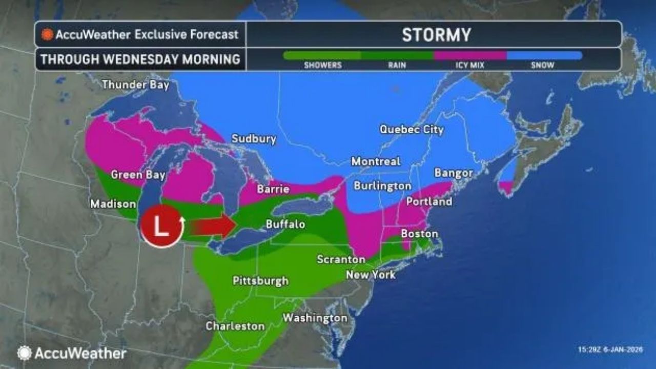
Northern tier faces yet another round of snow, ice
As a storm travels east over the northern tier, the air near and south of Interstate 80 will be too warm for snow or ice and too dry for widespread drenching rains. A few rain showers combined with sleet are anticipated along Interstate 80 across Pennsylvania’s upper elevations.
Further north, slippery conditions are forecast, particularly on untreated roads and steep surfaces.
An icy combination of sleet, freezing rain, and snow is forecast from Minnesota to parts of Wisconsin, northern and central Michigan, upstate New York, and central New England.
Even minor ice buildup can provide hazardous traffic conditions, especially on untreated roadways.
Just enough cold air is forecast to allow snow accumulation from the beaches of Lake Huron eastward through southern Quebec, northeastern New York, and northern New England.
Snowfall is expected to range from 1 to 6 inches across the zone, with an AccuWeather Local StormMax™ of 12 inches likely in south-central Ontario, the Green and White Mountains of New England, and southeastern Quebec near the US border.
Much of the eastern two-thirds of the country is anticipated to get a reprieve from the recent cold this week. Temperatures may set daily records from Texas and the southern Plains into the Southeast on Wednesday, followed by the southern Atlantic Seaboard on Thursday.
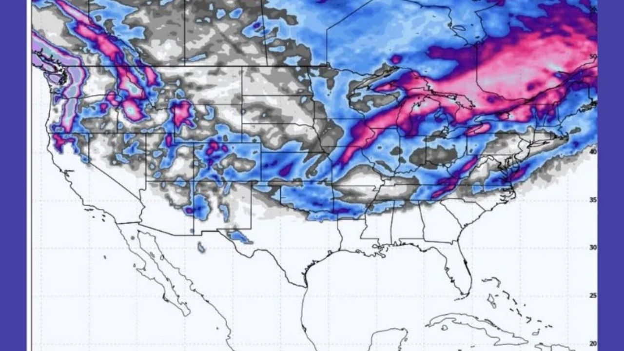
Western US storm to affect dozens of states east of Rockies late this week
A cross-country storm that brought rain and snow to the West on Tuesday is projected to pass through Texas on Thursday before moving near the Great Lakes region on Thursday night.
This lead storm of a duet will be the smaller of the two for the remainder of the week. A coating of a couple of inches of wet snow is expected from northern Iowa to northern Michigan.
The second section of the storm, as well as the main body, will arrive in roughly 24 hours.
As this massive storm travels forward, it will carry Pacific moisture before tapping into extra moisture from the Gulf of Mexico. This system is forecast to bring a wide range of precipitation to the central United States from Friday to Saturday, including thunderstorms, heavy rain, snow, and ice.
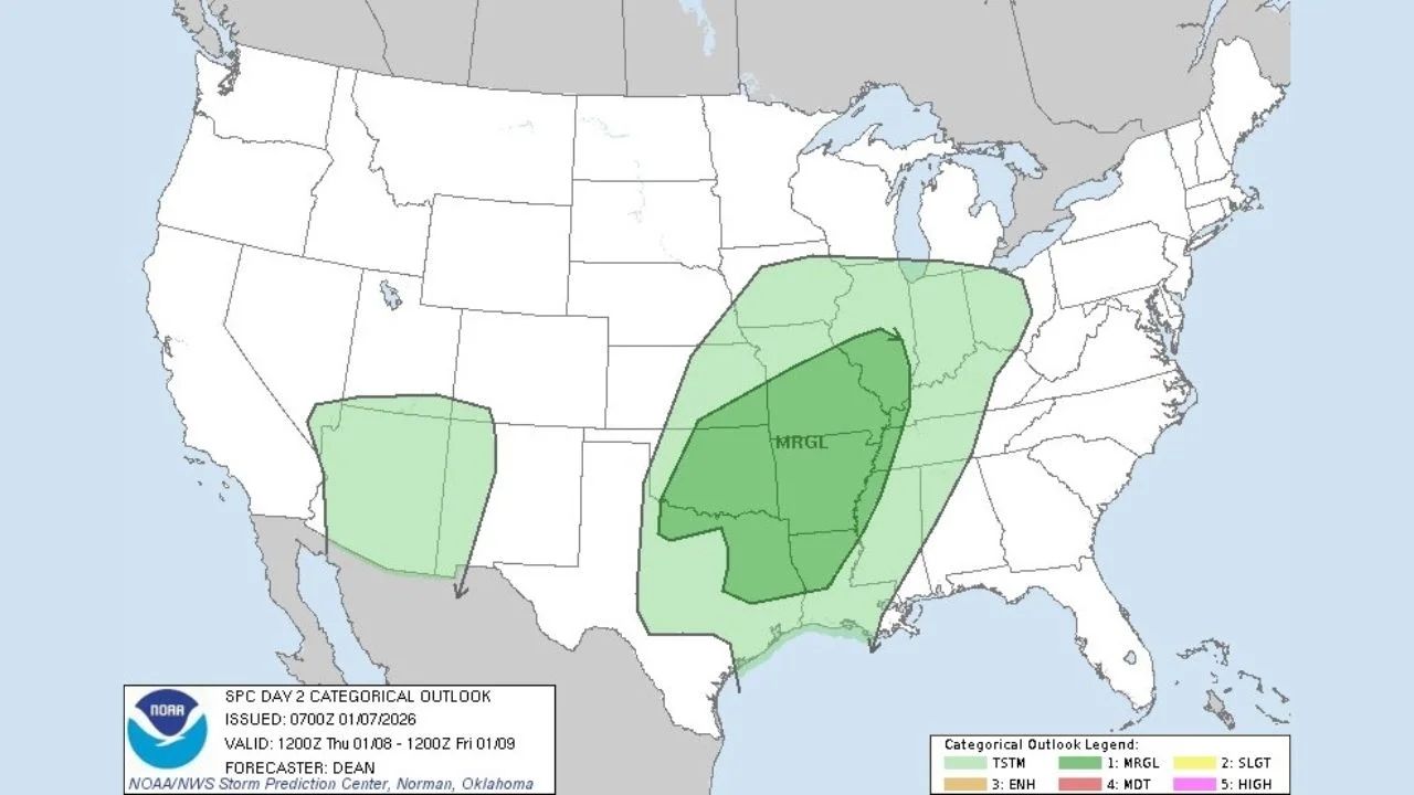
Severe thunderstorms are expected in eastern Oklahoma, northern Texas, far southeastern Kansas, and sections of the lower Mississippi and Ohio valleys on Thursday and Friday.
Additional gusty to severe thunderstorms are possible across the Southeast this weekend.
The storm’s route will determine the exact location of the changeover between rain, wintry mix, and snow throughout the Plains.
The expansion of warmer air ahead of the storm may limit the wintry mix to northern Maine, further east.
Travel conditions in much of the Central and Eastern states are expected to improve from Tuesday to Wednesday but then deteriorate from Friday to Saturday, including at airports.
Colder air to fight back by the weekend
The storm is expected to reach the Northeast late this week, but it may slow as another storm approaches.
As colder air moves into the Great Lakes region on Friday and Saturday, strong winds may turn rain into accumulating snow, with the possibility of another round of significant lake-effect snow.


Leave a Reply