PEORIA, Ill. (WMBD) — A major pattern shift is still expected to bring winter-like cold to Central Illinois at the end of November, and now conditions are looking increasingly favorable for the season’s first widespread accumulating snow over Thanksgiving weekend.
Key Takeaways
-
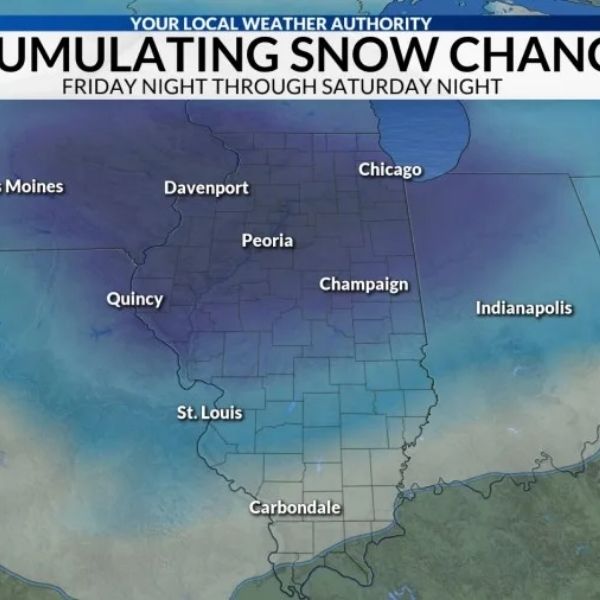
Snow likely Friday night into Saturday
-
Growing confidence in accumulating snow across Central Illinois
-
Snow totals remain highly uncertain
-
Storm track and a possible changeover to rain still unclear
After a cold and dry Thanksgiving, a storm system moving out of the Rockies is expected to bring accumulating snow to the region Friday night and Saturday. The exact storm track remains uncertain, but both likely paths include a period of snow.
Southern Track
A fast-moving system that stays cold enough to support all or mostly snow from Friday night through Saturday night, potentially leading to more significant accumulations.
Northern Track
A slower system that starts with snow Friday night, but tracks far enough northwest to pull in warmer air on Saturday, changing snow to rain. Rain could linger into Sunday under this scenario.
Forecasters currently lean slightly toward the southern track, though a middle-ground solution is also possible, which could mean a messy transition from snow to rain on Saturday.
Because of the uncertainty, snowfall amounts cannot yet be accurately projected. For now, the National Blend of Models shows a high probability of at least 1 inch of snow across the region, though those chances may shift as the storm track becomes clearer.
Anyone traveling over the holiday weekend should monitor forecast updates in case plans need to be adjusted.
This article has been carefully fact-checked by our editorial team to ensure accuracy and eliminate any misleading information. We are committed to maintaining the highest standards of integrity in our content.


Leave a Reply