An Alberta clipper and Arctic front threaten snowy, frigid travel from the Midwest to the Northeast from New Year’s Eve into early 2026. Driving should be done with caution.
An Alberta clipper storm and a trailing Arctic front will bring snowy and freezing conditions for automobiles and air travelers from the Midwest to the Northeast in the last hours of 2025 and early in 2026.
Snow showers and stronger snow squalls are likely along the storm track and farther south, with conditions ranging from Wisconsin, northern Illinois, and Michigan to northern New Jersey, southeastern New York, and New England.
The clipper storm’s snowy effects will hit Indiana, Ohio, Pennsylvania, and upstate New York during the late hours on Wednesday and Thursday, when New Year’s Eve travelers are on the road.
Conditions can soon alter. Motorists on Interstates 70, 80, 90, and many others in the region may see dry roads and clear vision one minute, then encounter whiteout snow and slick roadways the next. Similar situations in recent days and years have resulted in deadly pile-ups.
Plunging temperatures during and after snow squalls can cause wet tracks on some roadways to freeze rapidly, increasing the emergency stopping distance. Due to the pressure to drive at the posted speed limit, interstate highways can be the most dangerous choice during snow squalls.
Those who must travel may choose to take secondary roads as the squalls approach or wait it out, giving crews time to apply treatment before completing the journey. Some squalls may continue much longer than the average 5 minutes, causing extended delays in ground transport. Pack winter clothing, blankets, drinks, and high-energy snacks in case of a long-duration highway delay.
As squalls move away from the Great Lakes in the Midwest and Northeast, lake-effect snow bands will shift around and strengthen as reinforcing Arctic air sweeps in behind the clipper storm from Wednesday night to New Year’s Day and into the weekend.
Experienced drivers understand that in the region where snow bands persist, accumulations of many inches per hour can occur in some regions, while others may just see a few flurries. Traveling under such conditions can be risky, if not impossible. A longer, more southern path may lower the likelihood of encountering such strong lake-effect snow bands.
Airline customers in the Midwest and Northeast should expect delays due to deicing operations and icy runways where snow is present.
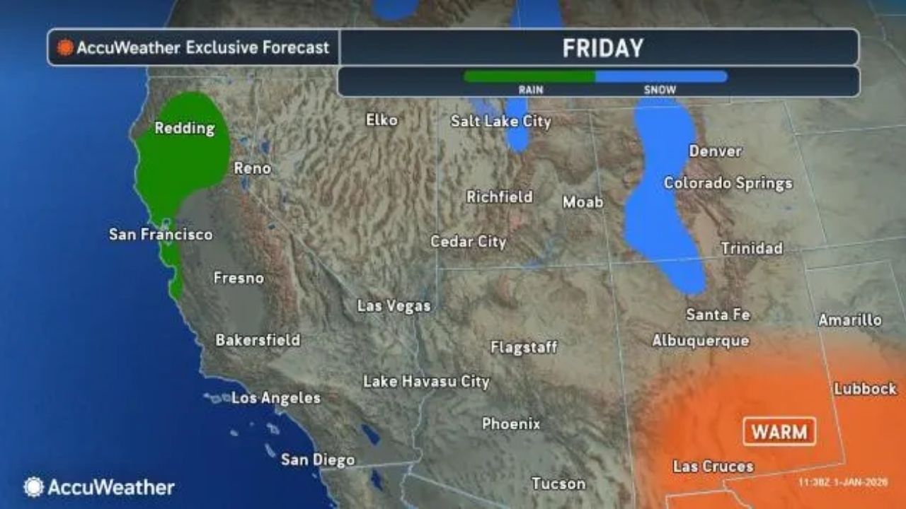
Even if the sky is clear at the departure airport, ground stops and relocated workers and aircraft can cause delays across the United States. A major downpour expected to impact California and several other Western states through Friday may cause significant aircraft delays in Los Angeles, San Diego, and San Francisco.


Leave a Reply