NOAA’s Climate Prediction Center forecasts above-normal temperatures and rainfall across the Southeast for January 7–11.
Temperature Outlook:
-
Above-average warmth expected across Florida, Georgia, Alabama, South Carolina, and extending north into Tennessee and North Carolina.
-
Southeast likely to see the strongest warming relative to early January norms.
Precipitation Outlook:
-
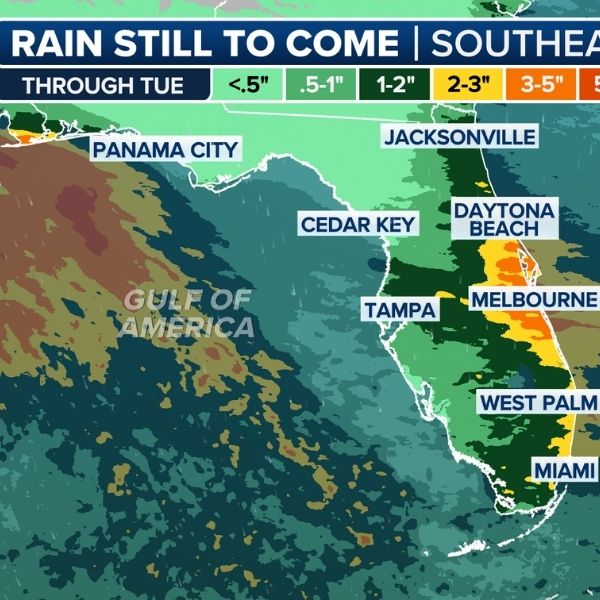
Above-normal rainfall expected across most of the Southeast.
-
Multiple weather systems could bring repeated rounds of rain, rather than prolonged dry periods.
-
Rain will be the dominant precipitation type, with no widespread winter weather expected.
-
Moderate rainfall could cause localized ponding, especially along major corridors like I-75, I-85, and I-95.
Impact for Residents:
-
Expect wet roads, reduced visibility, and intermittent travel delays during heavier rain.
-
Occasional thunderstorms are possible if instability develops, but widespread severe weather is not predicted.
Reminder:
-
Forecasts describe overall trends, not specific storm timing.
-
Residents should monitor local National Weather Service updates as the period approaches.
This sets up a mild, wet stretch for the Southeast to start the second week of January.
This article has been carefully fact-checked by our editorial team to ensure accuracy and eliminate any misleading information. We are committed to maintaining the highest standards of integrity in our content.


Leave a Reply