
A quieter and drier weather trend is predicted to settle across Arizona and New Mexico by mid-January, delivering below-average precipitation and reducing the likelihood of rain and snow across most of the Southwest.
According to the National Weather Service Climate Prediction Center, Arizona and New Mexico are expected to receive below-normal precipitation from January 9 to 13, with temperatures trending near to slightly above seasonal averages. This structure allows for fewer storms to pass across the region and longer periods of dry weather.
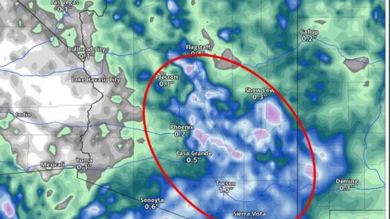
Rainfall chances remain low in Arizona’s deserts, including Phoenix, Tucson, Yuma, and the lower Colorado River Valley, resulting in mostly dry conditions and limited traffic disruptions along I-10, I-17, and U.S. 60.
Precipitation appears to be minimal throughout New Mexico, including Albuquerque, Santa Fe, Las Cruces, and Roswell. Snow potential in higher terrain, such as the Sangre de Cristo Mountains and the Mogollon Rim, remains below average for mid-January, lowering the probability of severe winter weather on mountain highways.
Residents should be aware of low overnight temperatures, patchy morning frost, and localized valley fog where skies clear. Overall, the dry weather is predicted to last until mid-January, although additional updates may be issued if storm tracks change south later in the month.


Leave a Reply