Dangerous weather is returning to the Pacific Northwest this week as heavy rain and significant snowfall impact the region once again.
According to The Weather Channel, western Washington has already received 2 to 12 inches of rain over the past several days, with isolated areas seeing as much as 17 inches. The excessive rainfall has saturated soils, increasing the risk of landslides and debris flows, especially in recently burned areas.
Heavy Snow Targets Cascades and Northern Rockies
On Tuesday, Dec. 16, the National Weather Service issued a Winter Weather Warning for large portions of Washington as the region prepares for intense snowfall.
“Heavy snow will occur over much of the northern Cascades this evening before expanding into the southern Cascades beginning Wednesday morning following the passage of a potent cold front,” the NWS said. “Several feet of snow are expected to accumulate over the Cascades and Olympics by Thursday morning.”
Snow is also expected to spread into the Northern Rockies, where 1 to 2 feet could accumulate on Wednesday, with isolated higher totals possible. The NWS noted that wind, winter, and flooding-related watches and warnings remain in effect across much of the Northwest for at least the next couple of days.
Forecast totals include 10 to 20 inches at Stevens Pass and 18 to 36 inches at Mount Baker, with wind gusts reaching up to 65 mph.
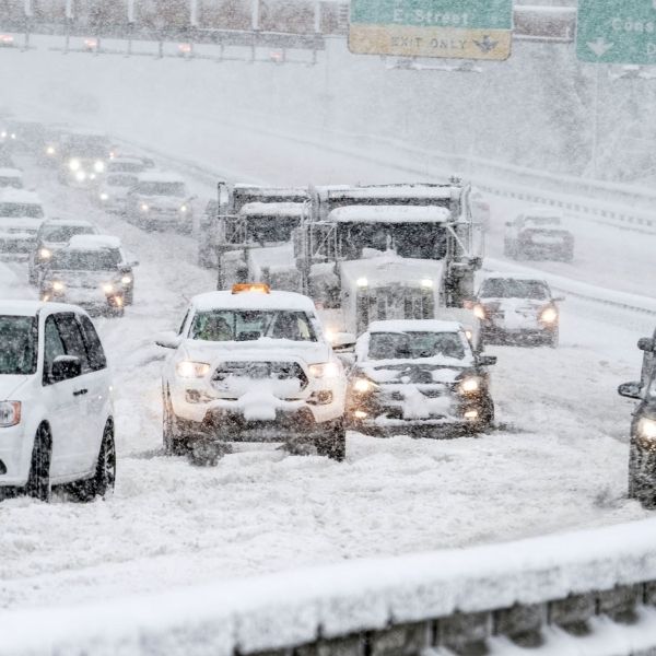
Travel Discouraged as Conditions Worsen
The National Weather Service strongly advised against travel in the affected areas, warning that conditions could make travel “very difficult to impossible.”
“If you must travel, keep an extra flashlight, food, and water in your vehicle in case of an emergency,” the agency said. “Prepare for possible power outages. Persons should consider delaying all travel. Motorists should use extreme caution if travel is absolutely necessary.”
The Winter Weather Warning remains in effect from Tuesday morning through 10 p.m. PT on Wednesday, Dec. 17.


Leave a Reply