Meteorologist Max Velocity warns that the U.S. is entering a period of “chaotic” weather this weekend, as larger, back-to-back storm systems replace calmer conditions. This pattern could disrupt travel, schools, and daily routines for millions, even in areas that haven’t yet experienced extreme winter conditions.
Great Lakes and Northeast: Historic Lake-Effect Snow Possible
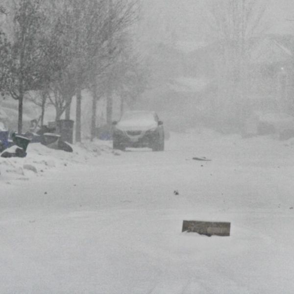
Velocity highlights Lake Ontario, particularly near Syracuse, New York, as a potential hotspot for lake-effect snow. Snowfall totals could exceed 50 inches within roughly 40 hours in some areas. Persistent bands of snow may bury one town while leaving a nearby community largely untouched, creating treacherous travel conditions and significant disruption.
Earlier snow squalls across Ohio, Pennsylvania, and New York have already caused near-whiteout conditions, and more bursts could still create sudden travel trouble outside the main bands.
Arctic Air in Place, Warm Surges Loom
A northwest jet stream is funneling Arctic air from North Dakota through Maine, keeping cold conditions reinforced across the Midwest and Northeast. However, by early next week, a ridge of high pressure could push record-breaking warmth into the central U.S., with temperatures up to 35 degrees above normal in some areas.
This sudden warmth over snowpack could lead to rapid snowmelt, slush flooding, and icy refreezes, highlighting the risks associated with big mid-winter warm-ups. Even Florida is seeing “Florida cold” in this volatile setup.
Southeast: Thunderstorms and Isolated Severe Weather
Velocity warns the Southeast to monitor a shortwave trough and Pacific energy fueling thunderstorms Friday night into Saturday. While a massive outbreak isn’t expected, isolated tornadoes and damaging winds are possible in Florida, Georgia, South Carolina, Alabama, and Mississippi. Marginal severe risk doesn’t mean nothing happens — the storms that do intensify can cause real damage locally.
West Coast: Storms and Volatile Jet Stream
By Sunday into Monday, troughing along the West Coast could trigger repeated storms, with energy rolling over the Rockies into the Plains. This shift toward a wavier, meridional jet stream will increase extremes: deeper cold shots, stronger warm surges, and shifting storm tracks.
Velocity expects multiple storm systems to impact large parts of the country in the first half of January, with growing uncertainty the farther out forecasts go.
What Comes After the Warm-Up: Potential Arctic Blast
Historically, such mid-winter warm spikes are often followed by cold “payback.” Max Velocity predicts the possibility of a colder push in mid-January, increasing the risk for snow and ice storms. While snow is disruptive, ice can create dangerous travel and power hazards with even a small event.
Bottom Line
The U.S. is entering a highly active, volatile winter pattern. Expect swings between snow, ice, and unusually warm temperatures, sometimes in the same region within days. This is not a simple “cold” or “warm” spell — it’s a dynamic pattern that demands attention and preparedness for multiple hazards.
People across the country should stay alert, monitor forecasts closely, and plan for rapidly changing conditions in the weeks ahead.
This article has been carefully fact-checked by our editorial team to ensure accuracy and eliminate any misleading information. We are committed to maintaining the highest standards of integrity in our content.


Leave a Reply