
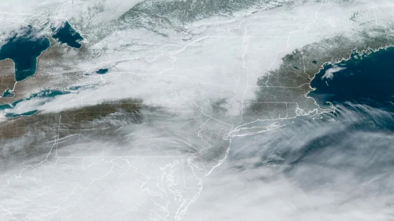
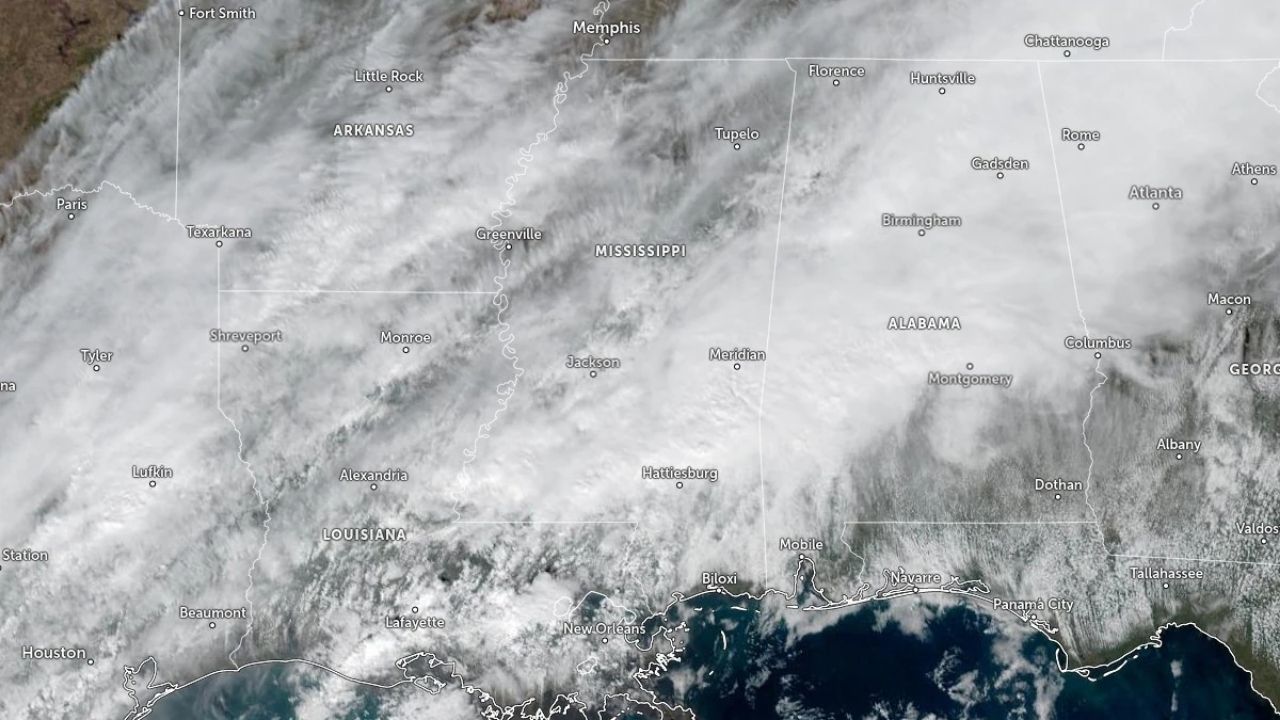
As the cold persists in the northeastern United States, bouts of snow will cause travel disruptions in parts of a dozen states until early next week.
The procession of clipper storms and freezing air from Canada will continue to produce snowy troubles for travelers from the Great Lakes region to parts of the Northeast this weekend, as well as on Monday, when millions will return to work and school.
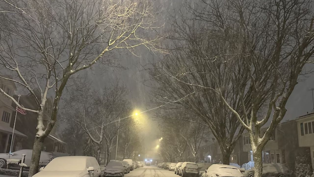
Skiers will be pleased with the sustained cold and snowfall throughout the weekend. Many locations, from the Upper Midwest to the interior Northeast, may see a new round of snow every 24 hours or less. Highway departments and private contractors will be busy keeping up with the regular snowfalls.
The following is a chronological list of snow and ice events.
Following the clipper storm and Arctic front that spread snow from northern Minnesota on Wednesday to the mid-Atlantic and New England coasts until New Year’s Day, another clipper began to create snow in the Upper Midwest on New Year’s Day.
The storm’s steady snow will gradually fade as it moves across the Northeast into Friday morning, but there will be enough to provide a fresh coating on some roads from southern Michigan and Ohio to West Virginia, western Maryland, western and central Pennsylvania, upstate New York, and interior New England.
As with many previous clipper storms, the Great Lakes will boost the snow slightly, and the lake effect will be energized in the aftermath.
Following the clipper storm that exited the Northeast on Friday, another will follow closely behind. That fast-moving storm, which will bring mostly light snow, will spread from northern and central Michigan to upstate New York, northern Pennsylvania, and much of New England by Saturday night.
Most of this area’s snow will be 1–2 inches, with some areas getting up to 2 inches. However, moisture from the Great Lakes can deliver several inches close to the beaches of Lake Superior, Lake Erie, and Lake Ontario.
Lake-effect snow will develop from late Saturday to early Sunday, primarily across the northern and eastern lakes.
A slightly larger storm and precipitation shield will develop from Sunday afternoon to early Monday across the Upper Midwest, followed by the Northeast from Monday to Monday night, in what should be the final clipper storm of the series before a pattern change next week.
This storm, along with its snow and ice, will travel ahead of a surge of warmer air over the Plains and less cold air in the Northeast.
Snow will fall from northern Minnesota to Michigan, then upstate New York, northern Pennsylvania, and New England, resulting in a new round of icy roads.
A brief period of freezing rain may glaze some surfaces on Sunday afternoon and night across the area extending from northern Minnesota to southern Wisconsin, as well as northeastern Illinois. Some locations in eastern Ohio, Pennsylvania, and northern New Jersey may receive the same on Monday. In rare circumstances, conditions may be treacherous enough to cause school delays and cancellations.
The Northeast jet stream dip that created the Arctic air waves will retreat toward Canada after the first part of next week.
As a result, air from the Pacific will come in, with temperatures approaching or above the historical normal.
Despite the warmer temperatures for much of next week, places with snow cover that become moist from daytime melting may freeze at night, posing a risk to pedestrians and automobiles, according to AccuWeather Meteorologist Alyssa Glenny.
Daily cleaning of sidewalks, parking lots, and roads may be required.


Leave a Reply